New airborne gravity data improves understanding of the bedrock in northern Norrbotten
The Geological Survey of Sweden (SGU) has compiled new airborne gravity data from measurements in northern Norrbotten. The new product will provide valuable new insight into the geological structures, rock boundaries and mineral potential within the survey area.
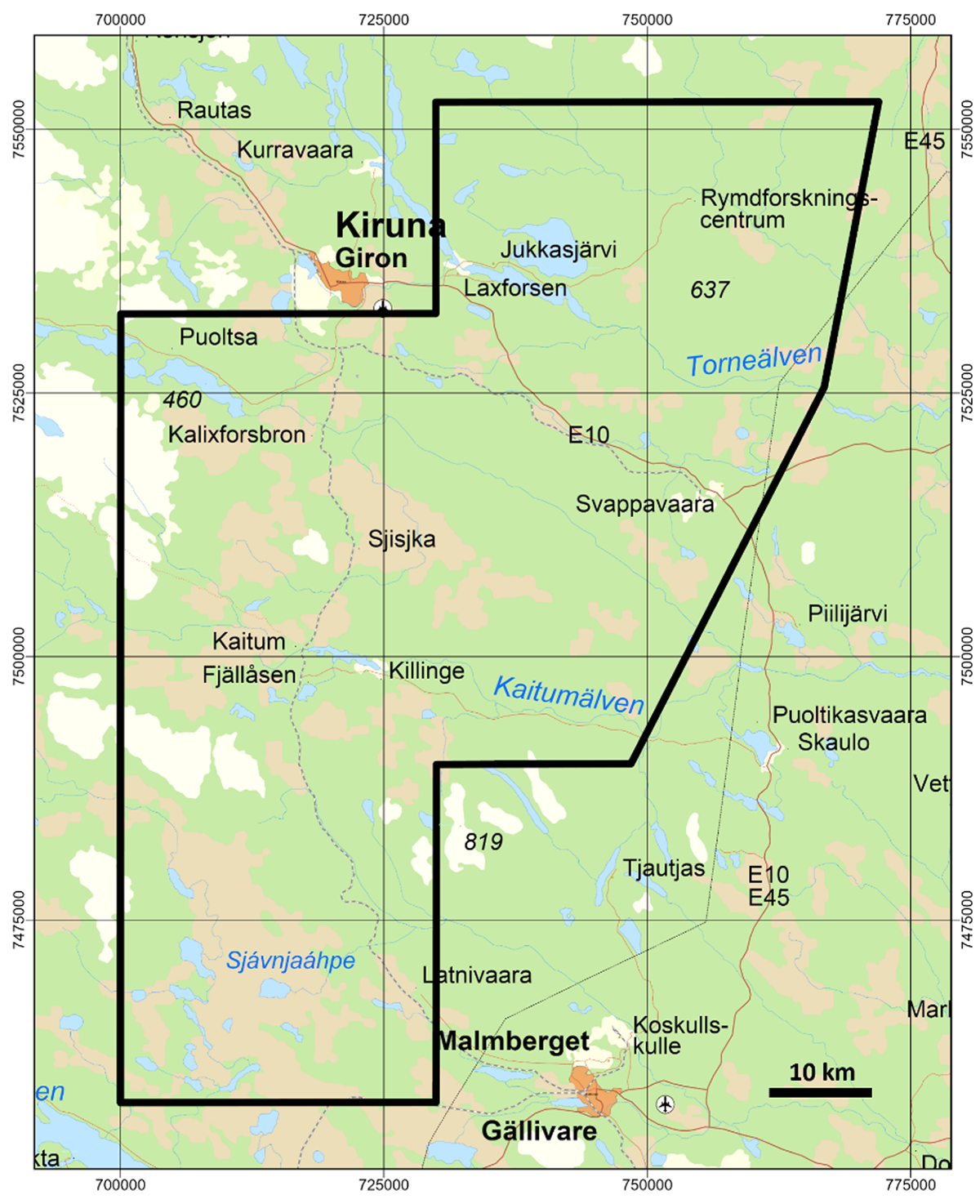
The new data product Geophysical airborne measurements, gravity (Geofysiska flygmätningar, tyngdkraft) contains airborne gravity data from measurements in northern Norrbotten. The product includes both Full Tensor Gravity Gradiometry (FTG) and Full Spectrum Gravity (FSG). Airborne measurements were conducted over two areas: (1) to the north of Kiruna were only FTG measurements were collected, and (2) to the east and south of Kiruna where both FTG and FSG measurements were collected. In the area east and south of Kiruna, the measurements were carried out with a nominal flight line separation and elevation above the ground of 250 m and 80 m, respectively. These new measurements complement the measurements that were made available previously by SGU north of Kiruna in 2013.
– This data provides new information about how the density of the bedrock varies both near the ground surface and at greater depth. Analysis and interpretation of this data therefore makes it possible to better understand the geological structures, rock boundaries and mineral potential within the survey area, says Mats Wedmark, head of unit at SGU.
The measurements have been carried out in areas where SGU is currently conducting geological investigations of the bedrock according to SGU's mapping plan. This work has been made possible by the government assignment, Enhanced mapping of areas with ore potential (Förstärkt kartläggning av malmpotentiella områden), which is operating between 2024 and 2026.
The map shows the geographical extent of the measurements (black polygon).
FTG measures small changes in the gravity field in multiple directions and provides high-resolution information about local density contrasts in the bedrock. FSG complements this by providing a coherent picture of the gravity field over the area. Together, these data can be used to interpret larger scale geological boundaries, structures, faults as well as geological units in the subsurface that are often not visible at the surface.
The data is particularly useful for geological mapping, 3D geological modelling and assessment of the area's mineral potential. By combining the airborne gravity data with bedrock geological observations, other geophysical data, and petrophysical and geochemical information, SGU and others using the data, can develop better models of the bedrock structure and better assess the area's potential for occurrences of metals and minerals.
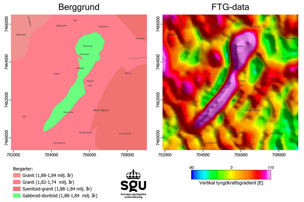
The images above show how a rock with a higher density, e.g. a gabbroid in the image on the left (green on the map), gives rise to clear and well-defined patterns in the gravity field (red areas in the image on the right). The iron and titanium mineralization Melkogruvorna is associated with the gabbroid.
The need for better geological knowledge to find occurrences of critical raw materials is increasing in line with the climate transition, electrification, digitalization and increased demands for security of supply. Many metals and minerals are classed as critical as they are needed for, batteries, power grids, wind power, electronics, defence technology and other strategic industries which are of great importance to the function of society. While at the same time many of these metals and minerals are connected to vulnerable or concentrated supply chains.
By making this new product Geophysical airborne measurements, gravity (Geofysiska flygmätningar, tyngdkraft) available for download as open data, SGU contributes to a strengthened knowledge base for mineral resource assessment, urban and regional planning and research in northern Norrbotten.
Read more about Geophysical airborne measurements, gravity and download the data
Last reviewed 2026-10-12