

SGU's survey vessel Ocean Surveyor at Höga kusten, Sweden.
Photo: SGU.
SGU´s Survey Vessels
SGU's survey vessel Ocean Surveyor is a national state resource that serves as a one-stop shop for seabed issues. The vessel can be booked for missions or rented by public organisations. Here you can learn more about the vessel's equipment, expertise, and how to book it.
SGU is a highly qualified entity in the field of marine mapping. We conduct surveys of Sweden's marine areas, which demands meticulous handling of the collected data. The geological information we gather plays a crucial role in Sweden's economy, environmental sustainability, and for security.
Chartering our vessels
Read more on how to book our specially equipped survey vessels for marine mapping and research.
Ocean Surveyor
The S/V Ocean Surveyor underwent renovations from 2021 to 2022, transforming it to diesel-electric propulsion with the highest environmental class, IMO Tier 3, which includes nitrogen oxide purification. The vessel features a completely new bridge fitted with advanced control systems and electronic navigational charts (ECDIS). It has also been equipped with a state-of-the-art IT infrastructure, including a fibre optic network with high security and protection standards.
This 38-meter long and 12-meter wide catamaran is constructed from Kevlar-reinforced fibreglass and is classified for ocean-going traffic. It has a clear height of 22 meters beneath bridges and a draft of 3.4 meters. The vessel accommodates 17 berths across 12 cabins, in addition to a sickbay with two beds. The mess area seats 16 and also doubles as a meeting place. The day room is equipped with a small library and television. The ship’s lifesaving equipment is designed for 25 persons.
The vessel is self-sufficient for fresh water, utilising a reverse osmosis system. Its extensive fuel tanks, along with large refrigerators and freezers, enable sustained operations at sea for up to two weeks.
Operational control can be manual, via autopilot, or through dynamic positioning (DP). With satellite-based positioning equipment, two side thrusters on each side, and two stern propellers, the vessel can maintain a stationary position with metre-level accuracy or follow a predetermined route automatically.
The ship is outfitted with multiple fixed measurement systems, including single and multibeam echo sounders, underwater positioning systems, sediment echo sounders, side-scan sonar, multi-channel seismic equipment, both automatic and manual sound velocity profilers, underwater photography and video cameras, as well as current and oxygen concentration meters. A spacious room dedicated to data collection, processing, interpretation, and storage is conveniently located adjacent to the command bridge.
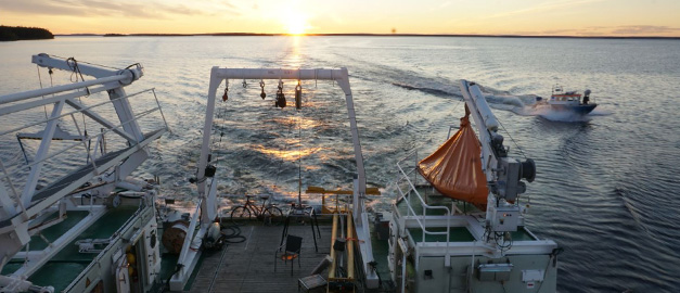
Additionally, the vessel boasts a large aft deck equipped with several winches, cranes, an aft ramp, and a moon pool, facilitating the use of various sampling and underwater camera systems.
Two laboratories are available on board directly connected to the aft deck: a rough lab for sediment, gamma spectroscopy, flora and fauna analysis, and a clean lab with fume hoods for environmental and water samples, as well as a sediment X-ray system for detailed sample studies.
Learn more about the survey vessel Ocean Surveyor and its equipment
Survey vessels Ocean Surveyor and Ugglan. Photo: Gustav Kågesten, SGU.
Ugglan
S/V Ugglan is an aluminium survey boat with a length of 9 metres, a width of 3 metres, an air draught of 2.7 metres, and a draft of 0.7 metres. Ugglan is transported either in the dock of the vessel or with a crane truck for standalone missions at the coast, lakes, rivers, or other smaller bodies of water. A water jet unit providing a maximum transport speed of around 25 knots powers the propulsion. The cabin accommodates two seats and a rack for computers and the electronics of the measuring equipment. A self-inflating liferaft for 4 people is located on the cabin roof.
Satellite-based positioning is used for navigation. The boat is also equipped with radar and AIS systems for propulsion in poor visibility conditions. With the help of a retractable electric propeller in the bow and automatic control of the water jet, the boat can remain stationary with the help of the GNSS system, enabling sampling with very high positioning accuracy.
The boat is equipped with several fixed measuring systems such as multi-beam echo sounders, parametric sediment echo sounders, underwater positioning, and SVP profilers.
Sampling with, for example, a corer and grab is performed on the foredeck using a crane with an electric winch. The equipment also includes an underwater camera.
Last reviewed 2025-02-03