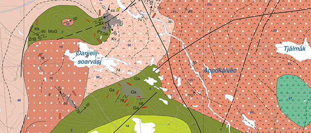
Excerpt from the Bedrock map 26J Jokkmokk NV
Map: SGU
New bedrock maps from project Sydvästra Norrbotten
There are now new bedrock maps for areas around Porjus, Jokkmokk, Tjåmotis and Luvos in Norrbotten. The maps are part of SGU's project for mapping ore potential areas and their geographical distribution.
The purpose of the project is to create modern, local bedrock geological and geophysical databases as well as maps that can form planning and resource management data for exploration companies, municipalities, county administrative boards and others in the Norrbotten County. The bedrock maps of the map areas 27J Porjus SV, 26J Jokkmokk NV/NO, 27I Tjåmotis SV/SO and Luvos NV/NO/SV are now published as downloadable PDF files.
Some of the rock types in the project area include deposits of iron, nickel, copper, zinc, lead, gold, silver, platinum group elements, manganese, and molybdenum, as well as industrial minerals such as graphite, wollastonite, uranium, quartz, and feldspar. The Kallak iron ore deposit is located within the map sheet area 27I Tjåmotis SO and the host rock is mainly a quartz trachyte formed about 1 870 million years ago.
The descriptions of the respective bedrock map have previously been published and can be searched at SGU Geolagret.
Last reviewed 2021-01-25
