Photo: SGU
Airborne gamma radiation measurements after the Chernobyl accident
On the morning of April 28, 1986, the alarm goes off at the nuclear power plant in Forsmark. It is the portals that measure gamma radiation on employees going in and out that measure levels above normal. The radioactivity appears to come from the shoes of workers arriving at the nuclear power plant. The worst nuclear accident in history has just been discovered and soon the fallout across the country will need to be mapped. A task that falls into SGU's airborne geophysical operations.
Initially, it is believed that the leak comes from Forsmark and all personnel who are not immediately necessary for safe operation are evacuated. Authorities and the government are informed of the situation and intensive work on mapping radioactivity in the area around the nuclear power plant is initiated. Soon, increased levels of radioactivity are also reported in other parts of the country and from the Finnish authorities. To determine the origin of the emission, SMHI makes calculations showing how the air masses, which are the carrier of the radioactive material, moved the days before. The calculations show that it probably comes from the nuclear power stations Ignalina or Chernobyl in the former Soviet Union. During the evening, the Soviet Union confirms that explosions have taken place at the Chernobyl nuclear power plant already the night between April 25th and April 26th.
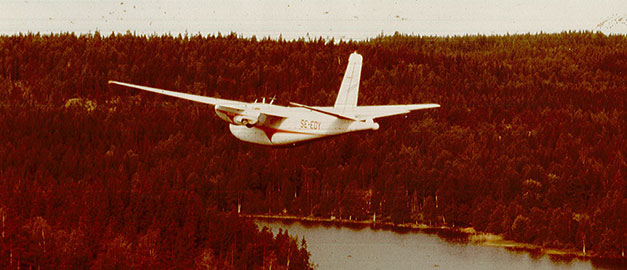
The day after the accident was discovered, SGU's airborne geophysics operations was contacted by the Radiation Protection Institute (SSI) with a request for help to map the fallout. The week before the flight measurement personnel had returned from a measurement mission in Botswana and now the measurement aircraft was in hangar of SGUs contracted flight operator in Torsby, almost ready for measurement. Some very intense weeks now started for everyone involved in the airborne measurements.
Account from 1986
Sören Byström and Peter Hagthorpe were two of those who took part in the measurements. Here's their account of what happened then:
"When the alarm came from Forsmark on April 28th, 1986, of a possible radioactive leak in Forsmark, we went out on the roof (Plushuset in central Uppsala) and measured the gamma radiation. The spectrometer showed a clearly elevated level and also that it was not 'natural radiation', information we provided to SSI (now SSM), in the afternoon. In the evening, the Soviet Union acknowledged that a Chernobyl reactor had failed.
On the night of April 29th it rained and the level of radioactivity rose significantly. After several telephone conferences with SSI, we received orders to equip the measurement aircraft and start measurements. Then followed several intense weeks, during the first week working hours exceeded 100 hours / person.
After a few days we had a decent routine on how the work should be done. The aircraft measured during the day and then landed at any airport that had a late flight to Stockholm. The day's data was sent with this flight and at Arlanda someone from the night shift waited and received the data which was then processed during the night. The next morning someone went to SSI with the latest measurement results that were evaluated by their experts and from SSI we received directives where the next day's flight measurement would be performed. After a week there was a firsthand-drawn map showing the fallout over Sweden."

Photo: SGAB.
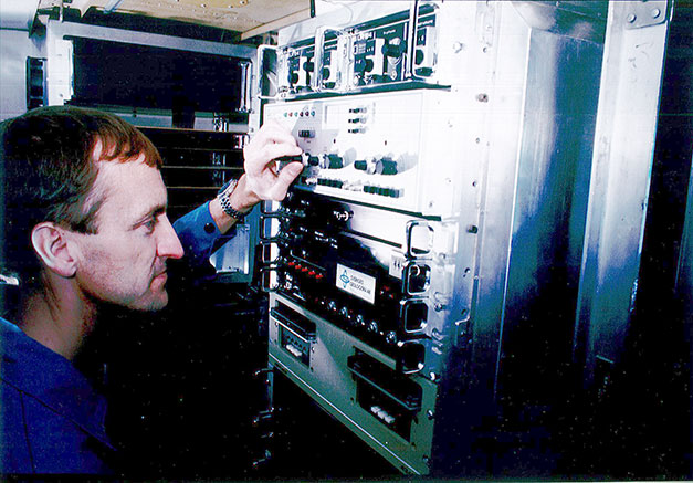
Sören Byström controls the measurement equipment in the specially equipped measuring aircraft. Photo: SGAB.
"The work continued at a somewhat slower pace but still seven days a week until the end of June 1986 with supplementary measurements of the areas where the fallout was more concentrated. During the autumn, the official map showing the level of cesium-137 over Sweden in May 1986 was produced.
This was before GPS and manual navigation was used. A few times when we were unexpectedly redirected to another part of the country, a gas station road map had to serve as the base for navigation. Software for processing was gradually created in the first few weeks, but much of the data processing in the first period was manual.
Control measurements were then carried out over a number of years to get an idea of how accurate the 1986 measurement values were and also to try to get an idea of how deep in the ground the radioactivity penetrated (a few cm to a decimeter) and if there was redistribution (largely no redistribution)."
SGU and radiation protection preparedness today
The Chernobyl accident contributed to improved radiation protection preparedness in Sweden, and since 1986, the airborne geophysical operations at SGU have been part of the Swedish national radiation protection preparedness - an expert support organisation led by the Swedish Radiation Safety Authority (SSM). The task of the expert support organisation is to support SSM with expert knowledge and measurement resources should a nuclear event occur. Within radiation protection preparedness, method development and practice are ongoing in order to maintain and develop competence.
Airborne radiation measurements are an important resource for mapping the extent of a radioactive fallout or for searching radioactive point sources during nuclear and radiological events. In the years 2016–2018, SGU participated in a project, funded by the Swedish Civil Contingencies Agency, with the aim of strengthening our ability to perform measurements in case of an incident. Through the project, we can now provide better decision support to the responsible authorities by improved methods for calibration, data analysis and map production, in addition we have increased the measurement capacity by now being able to equip and use two measuring aircraft at the same time.
Last reviewed 2020-09-22
