Geological mapping surveys
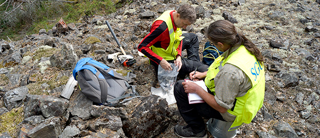
SGU is mapping Sweden's bedrock, soil and groundwater. We have the responsibility to fulfil society’s need for geological information.
Knowledge about the geological conditions around us – surface, soil, bedrock and the seabed – is a prerequisite for our prosperity and for a sustainable development of our society. SGU is the governmental agency in Sweden that has the task to fulfil society’s need for geological information.
Geochemical mapping
SGU's geochemical mapping researches the soils natural levels of metals and other important elements. The information tell us more about, for example; areas with gold, where there is a lack of important elements such as phosphorus and magnesium or risk of too high levels of elements like arsenic, cadmium etc.
The information from the geochemical mapping SGU does is used in for example mineral exploration, forestry, soil research, municipal planning, environmental monitoring and medical research.
Read more about geochemical mapping
Geophysical mapping
SGU's geophysical mapping is mainly done to get an understanding of the bedrock in places where it is covered by soil or water. This is why we do measurements of the magnetic field, gamma radiation, the electromagnetic field and the gravitational field. The measurements also give us a chance to “see” structures that occur deep down in the bedrock.
Read more about geophysical mapping
Mapping of bedrock
When we are mapping the bedrock we determine the rocks distribution, their mineralogical composition, genesis and age (relative and age) as well as any structures present. Certain projects research the bedrock’s technical properties to determine the different rock type’s use as building materials.
Information about the bedrock geology is used in, among others; physical planning, prospecting and in fields of environmental or health issues. The information is also important for universities and research.
Read more about Bedrock mapping
Mapping of soils
When we mapp the soil we collect information about the soil distribution, their components and properties.
Information about the soil is used as planning support for county governments and municipalities, as support to identify deposits with large groundwater reservoirs, during planning of construction plants and while trying to localize environmentally hazardous activities. The information can also be used when digging down wires, to determine stability conditions and in afforestation.
Mapping of groundwater resources
The aim of our mapping of groundwater resources is to provide an overview of the locations of large groundwater aquifers and of potential abstraction volumes. The aim is also to show the direction of groundwater flows and any areas where the groundwater may contain high concentrations of salt or fluoride. SGU also gathers information on Swedish drinking water wells, energy wells, major water supply sources, springs and groundwater chemistry.
SGU undertakes measurements of groundwater levels in observation pipes and wells in order to monitor how groundwater levels vary over the year. We also contribute to the national environmental monitoring of groundwater by taking samples for chemical analyses.
Last reviewed 2020-09-23
